January and February
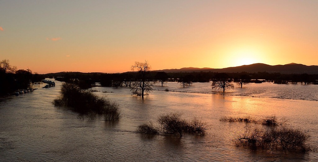
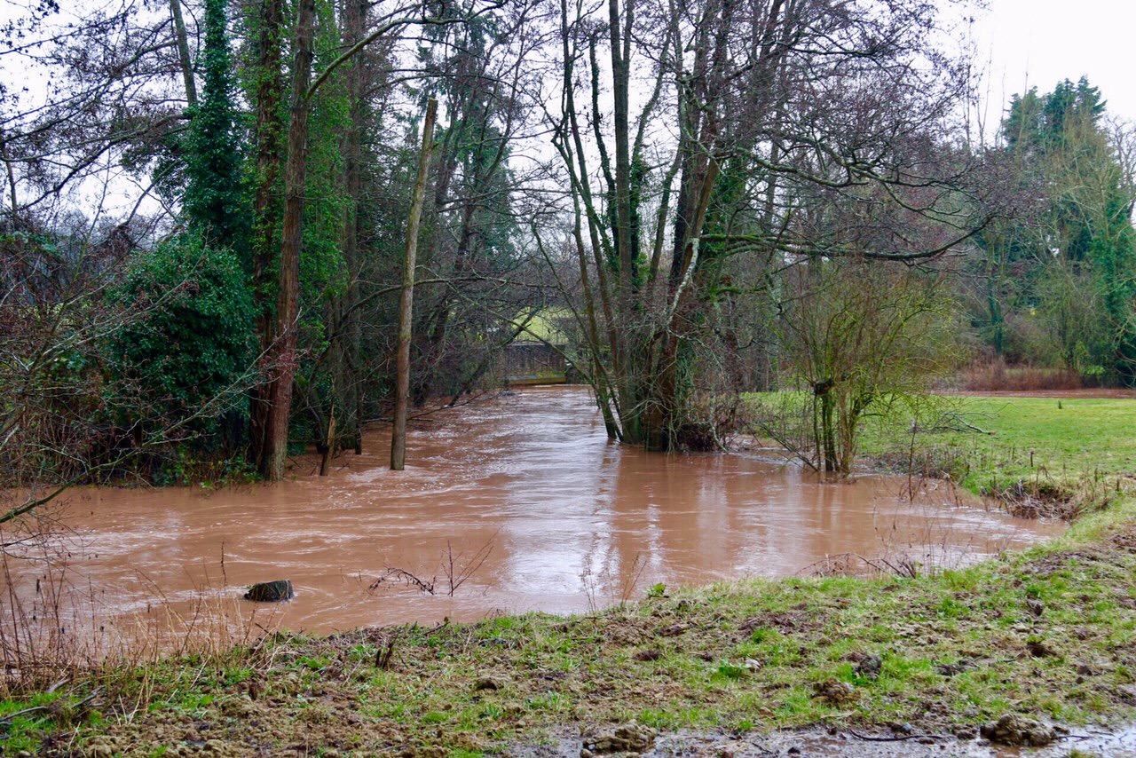
A conveyor belt of storms, pushed along by a supercharged jetstream, led to prolonged and widespread flooding across much of England during the first two months of 2014.
Our incident room in Tewkesbury was open 24/7 for 63 days between Christmas 2013 and the beginning of March. Across the Severn and Wye catchments hundreds of flood warnings were issued, barriers went up and down, river blockages were removed, reappeared and removed again. Our 250 local staff were pushed to the limits. I’ve seen bigger floods but never one as long lasting!

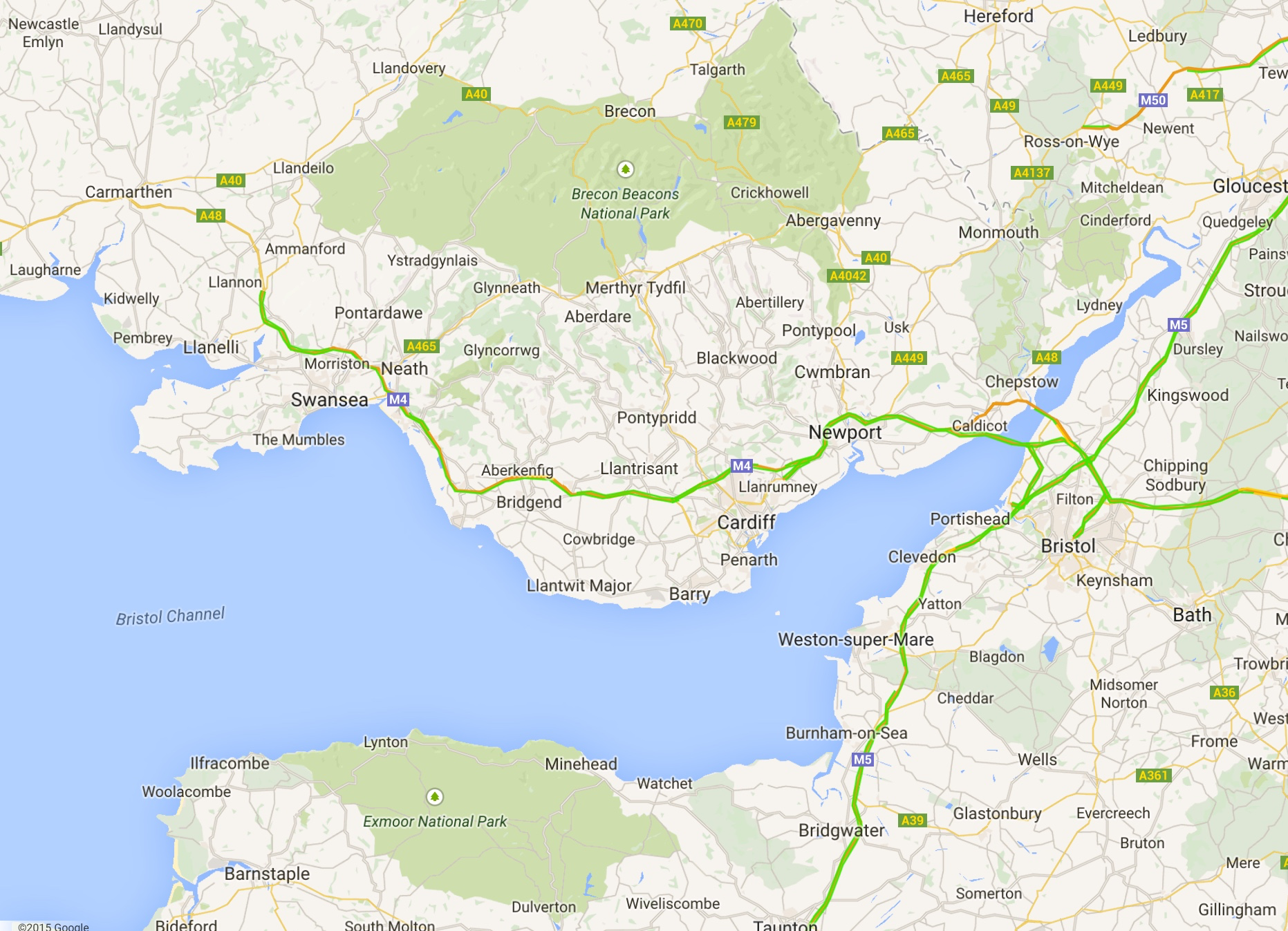
As 2014 started our immediate concerns were high tides and surges in the Severn Estuary rather than conventional river flooding. Storm systems barrelling in off the Atlantic were pushing water up the funnel of the Estuary and this was coinciding with very high tides. Our flood defences protected thousands of homes along the Estuary but in a few locations the water was so high it came over the top, causing flooding behind.

The power and speed of this type of flooding is awesome. Water levels rise very quickly and once water comes over the top of flood banks it travels a long way very fast!

I spent several days around Minsterworth just below Gloucester servicing the demands of a voracious media pack which took up residence around the appropriately-named Severn Bore pub (which was flooded).


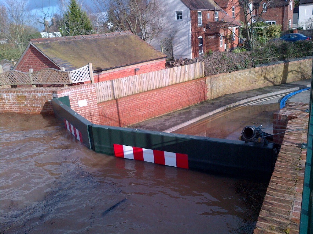
The tides receded soon after New Year but there was no time to relax as river levels were rising rapidly on the Severn upstream of Gloucester as a result of prolonged heavy rainfall. Our flood barriers started going up at Bewdley and Shrewsbury and flood warnings became more frequent and widespread as the rain kept coming.
A brief respite towards the end of January was swiftly followed by more high tides coinciding with surges at the start of February resulting in more flooding a disruption along the Severn and Wye Estuaries. We were growing increasingly concerned about the cumulative effects of high water and wave action on our flood defences on the Severn Estuary and a lot of time was taken making sure that they remained effective.
Flooding reached its peak around the middle of February. The cumulative effects of two months of exceptional rainfall across the south of England. On our patch the biggest problems were on the River Severn from Bewdley to Tewkesbury where levels were the highest seen for over ten years in many locations.
 Sadly over a hundred homes and businesses were flooded locally resulting in misery for those affected. My lasting memory was of the owners of the Rose and Crown pub at Severn Stoke who worked so hard, with the help of the local community, to protect their business from the rising water. Sadly efforts were in vain and they were badly flooded. Heartbreaking.


Other communities were also badly affected, including Callow End and East Waterside in Upton. In Worcester many homes in the Diglis area were also flooded. Spending time with flooded home and business owners is a sobering experience and probably the thing that drives me most to do whatever I can to help.
However, the local situation would have been much, much worse if it hadn’t been for our flood defences; most of which had been build since the huge floods of 2007.
Upton, Pershore, Kempsey, Powick, Bewdley and parts of Gloucester and Worcester would all have been flooded at the levels we experienced.
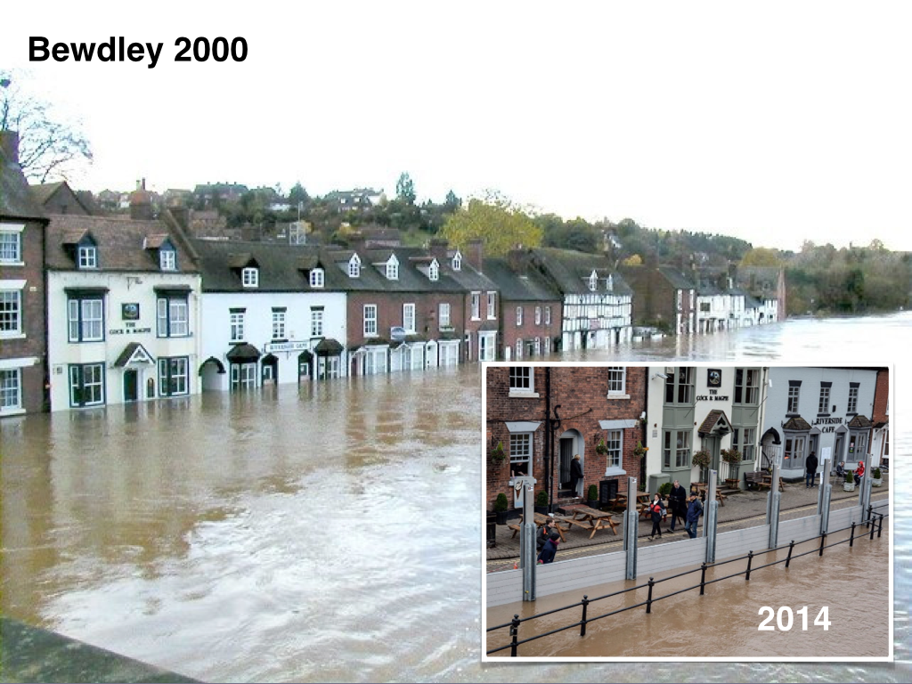
Over 500 homes and businesses in Worcestershire alone stayed dry because of our defences and the hard work of our folk who made sure they were in place and working properly.
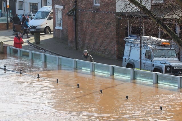
For a few days in mid February, Worcester became the centre of national media attention as water levels neared those of 2007. In addition to the flooding to some homes and businesses the transport network was seriously affected, causing gridlock and concerns for the town’s economy.
A huge operation involving all the responding organisations (police, fire, ambulance, councils, volunteers and even the army) swung into action to manage the situation and minimise the impacts. I was proud to be part of that response. It wasn’t perfect but I honestly believe it made a real difference.

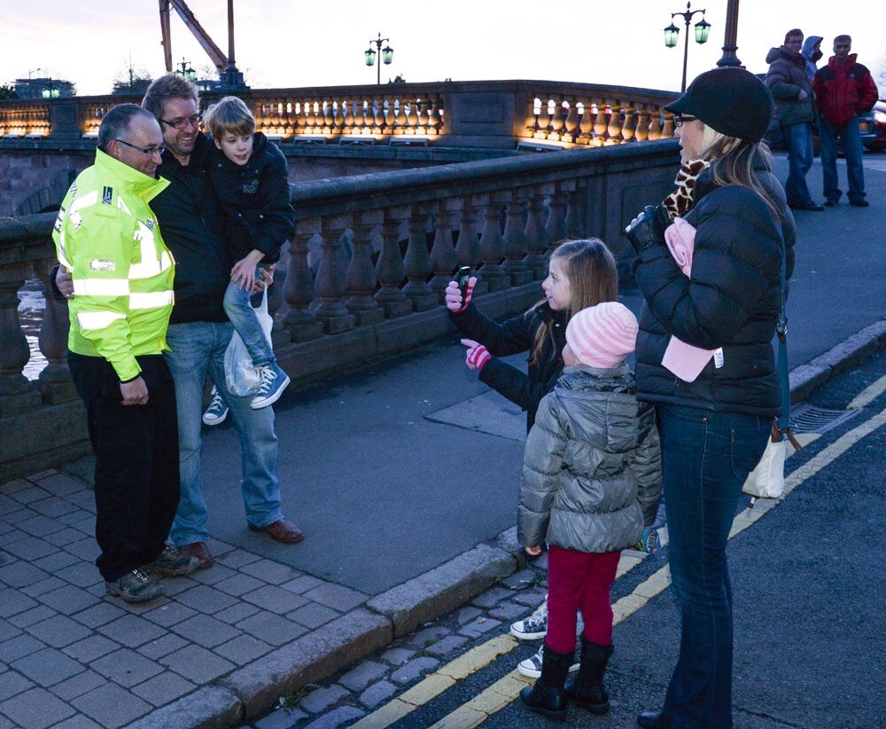
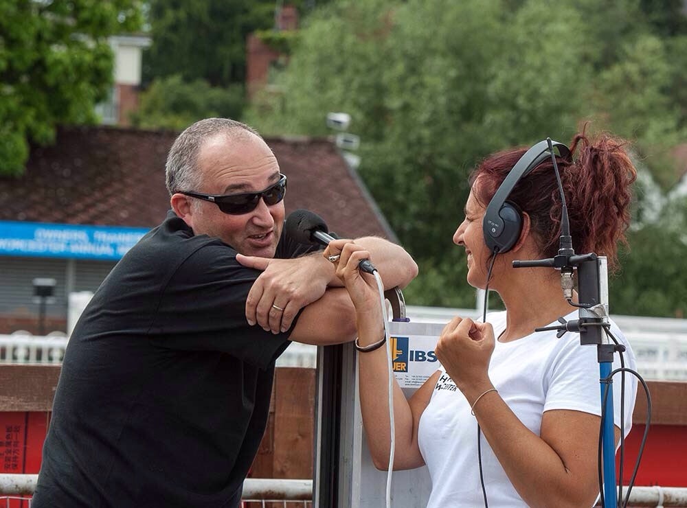
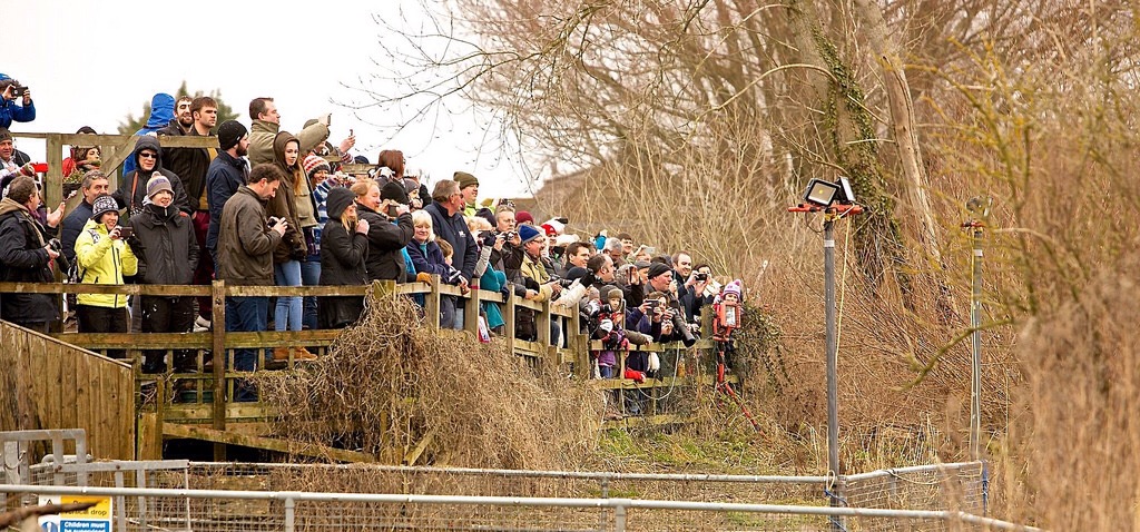
I spent two weeks on and around Worcester Bridge, juggling media interviews, Silver Command meetings and simply being the face of the Environment Agency.

Without doubt the most surprising and bizarre occurrence of the two months was the public reaction to my media appearances and social media ramblings. It may surprise you that signing autographs and posing for photos is not part of a normal Environment Agency working day!
By the end of February the worst of the flooding was over, although we had one more set of high tides and surges on the Severn Estuary to contend with. It had been a bonkers two months that had stretched us to the limits. Many of our people had been working solidly in all weathers, in 24/7 shifts since before Christmas. We were knackered!

Fortunately, flooding did not return and it wasn’t until the very end of the year that river levels began to rise again.
March
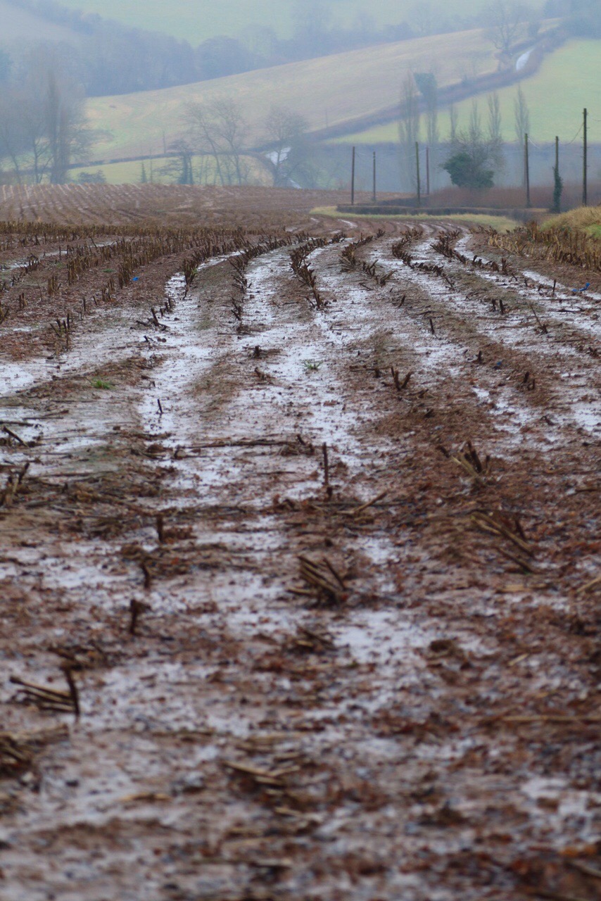
The waters may have been receding but much of March was spent dealing with the aftermath of the floods.
Months of high river levels and big flows resulted in debris building up against many bridges and structures. We need to remove these, both to prevent damage to the structures and to reduce the risk of flooding when the waters rise again. They are often also very unsightly and attract many complaints!

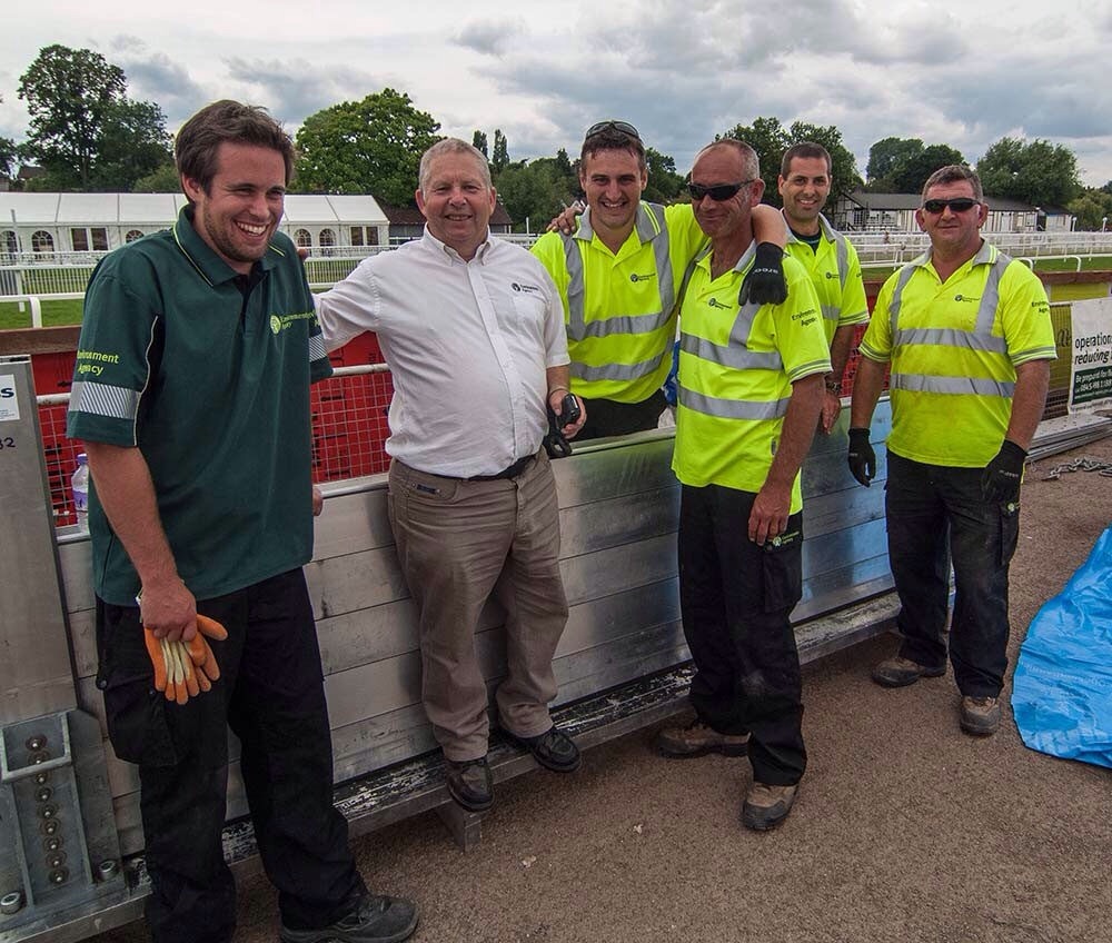
Probably the most high profile of these debris build-ups happens against Worcester Bridge. In early March we mounted an operation to remove remaining debris which included whole trees which had become wedged between the arches.
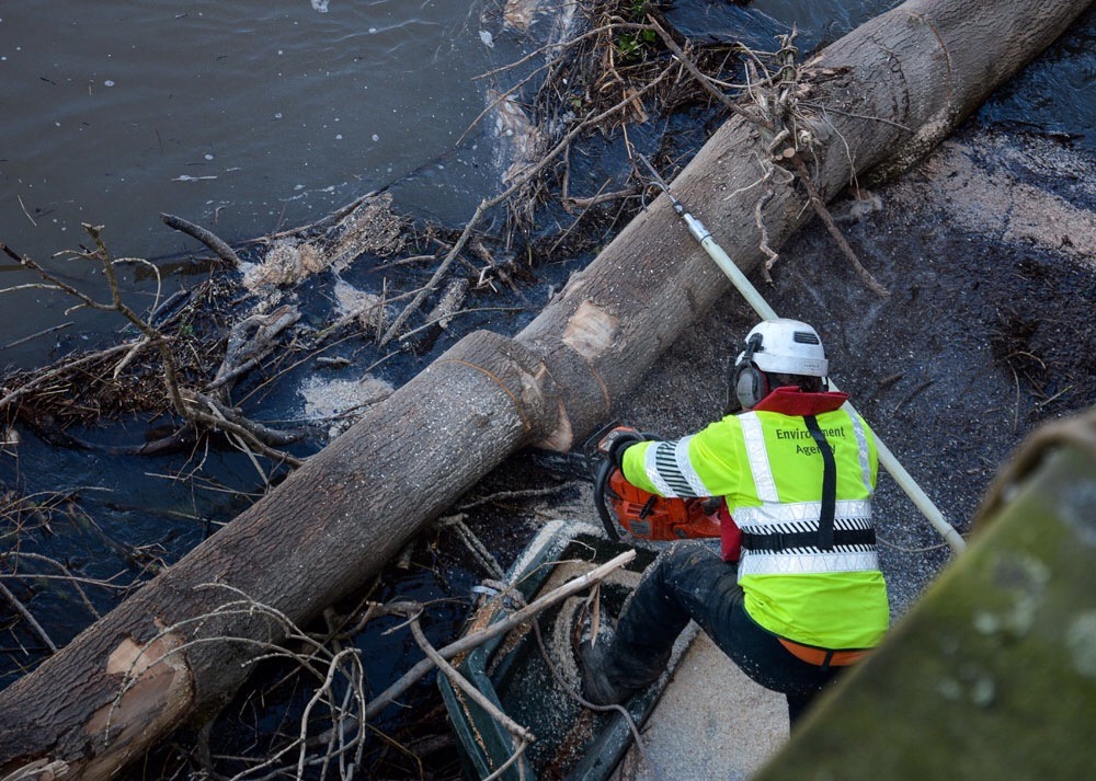
This is a really difficult job and I’ve huge respect for our guys who carry it out. Using chain saws, on little boats, in fast flowing water to tackle objects you can only partly see, is one heck of a challenge.

But our folk are the best in the business and the bridge (and many others) was left in perfect shape, ready for the next flood!
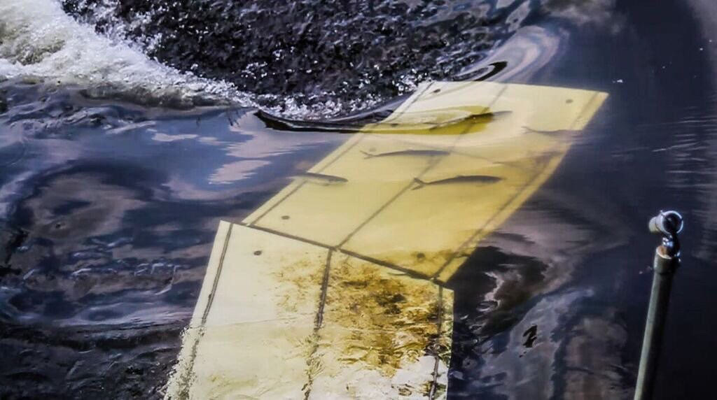
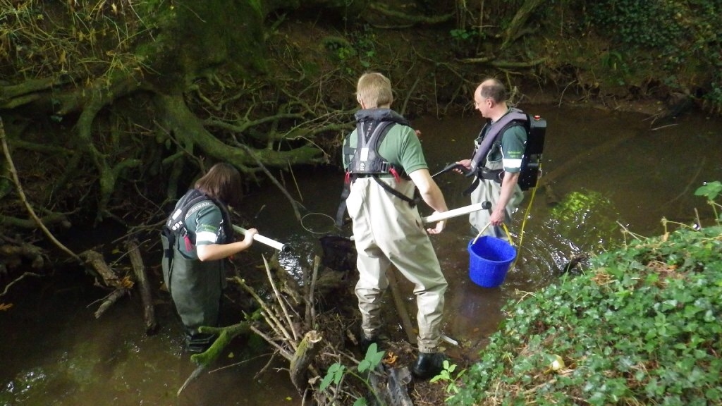
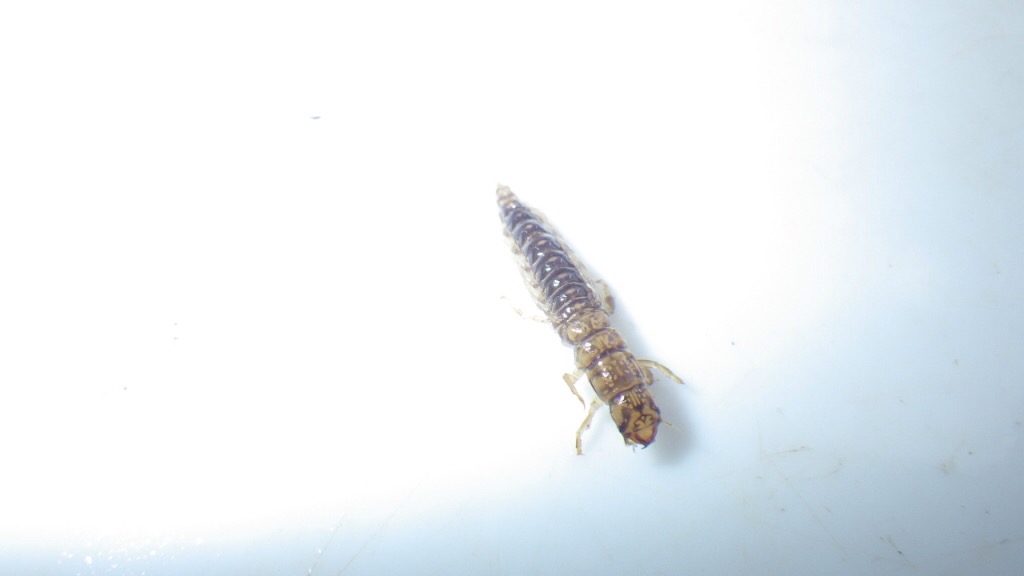
After every flood we have a number of places we always keep an eye on for stranded fish. Sounds strange, but our local flood plains are so big, and the flows so massive that fish often either get washed out or choose to explore the large expanses of flood water. When the water goes down they are left high and dry!
It’s usually more of an issue in summer floods when the fish are more active, so we were quite surprised when one of our hotspots – Worcester Racecourse – provided a good catch.
Once we’ve spotted stranded fish we have to wait until the water has almost gone so they are concentrated in a small area. Clearly this is a balancing act as if we wait too long they’ll suffocate or be eaten by birds!

A simple netting operation at just the right time yielded some magnificent pike, bream and roach which were measured and swiftly returned to the River Severn which was now back where it should be!
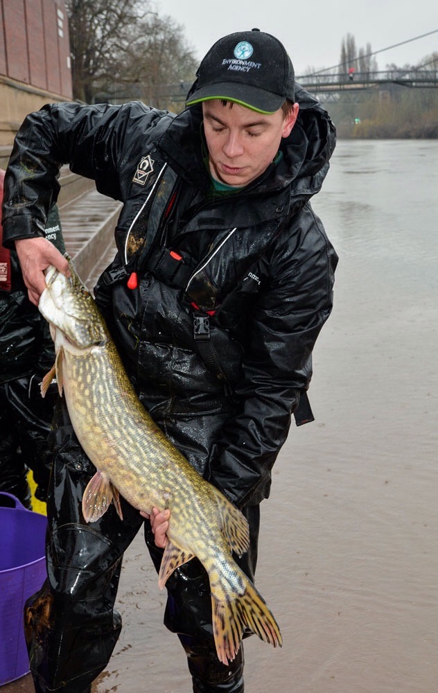
We are able to do this work because of the funding we receive from anglers who buy rod licences.

April
By April things were getting back on an even keel!
For the second year running there was a massive run of elvers (baby eels) on the Severn Estuary. This is against a background of many years of declining numbers and the reasons for it are not understood. However, it means more eels returning to colonise our local river network so it’s very good news!
We spent a lot of time on the high tides in March and April (when the main elver movements occur) making sure that the elver fishers on the Estuary were abiding by the rules of the fishery. The rules are designed to allow fishing but to limit the amount of elvers that can be taken.
Most elver fishers are very conservation-minded and much good work was done again this year in stocking Estuary-caught elvers further up the river system to assist their migration.

We also had a great day at the superb Cobhouse Fishery near Worcester, explaining our work on local fisheries and offering kids the chance to have a go a fishing.

It’s always a pleasure to see how enthused children are when experiencing angling for the first time. Many have never seen live fish outside a tank.

We hope that by giving them an early taster some will become hooked!

May
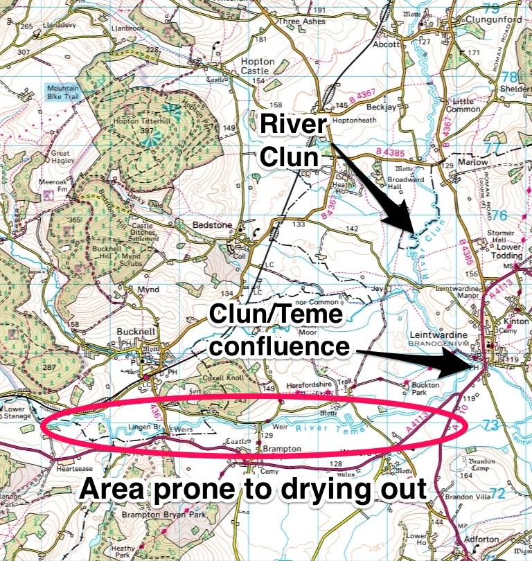
In May we were able to carry out some improvement works to the River Leadon in Herefordshire. The Leadon has suffered a bit over the last few decades. There have been a number of pollution incidents that have damaged the plants and animals that live in it; in some places run-off from fields is putting large amounts of nutrients and sediments into the water; and in others the banks have become bare and eroded offering little in the way of suitable habitat.
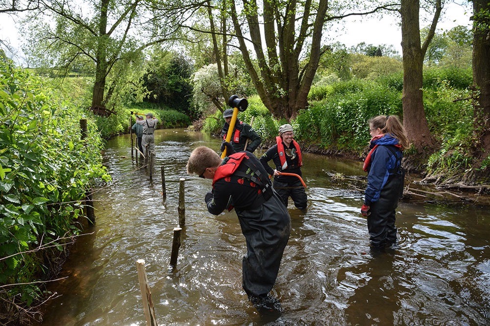
We worked with the Wild Trout Trust and local angling clubs to carry out some practical bankside improvement works. The aim is to work with the natural shape and flows of the river and create the right conditions for better quality habitat (for fish, plants and insects) to establish themselves.

We hope that the angling clubs will be able to put their new skills to good use and create more habitat in future years. Turning around the fortunes of a river like the Leadon is neither simple nor quick, but it is possible and the results are very rewarding.

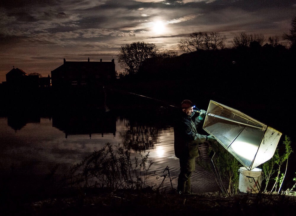
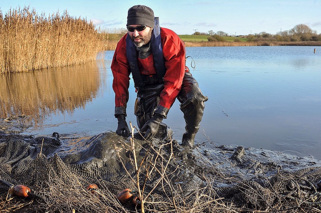
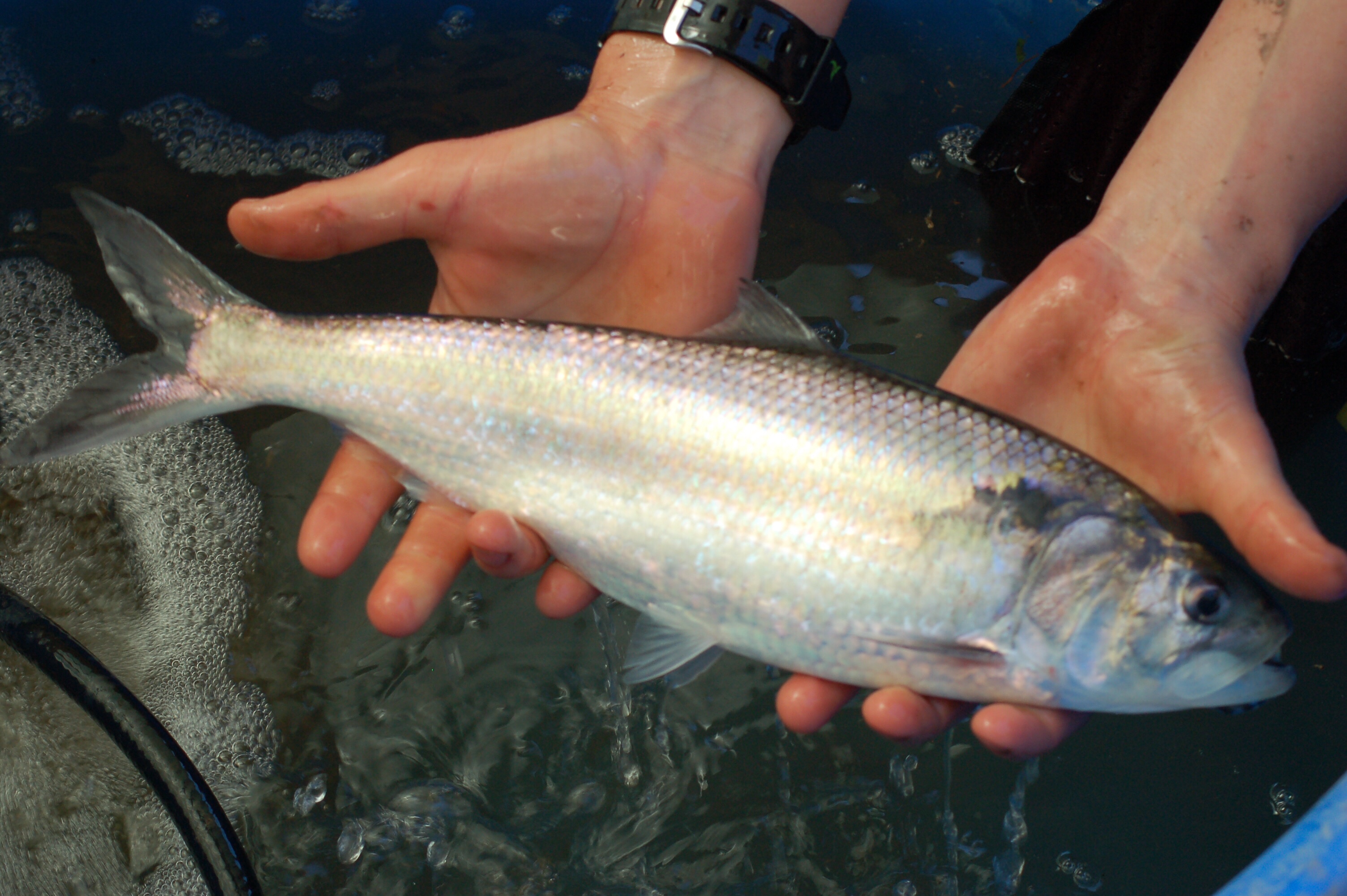
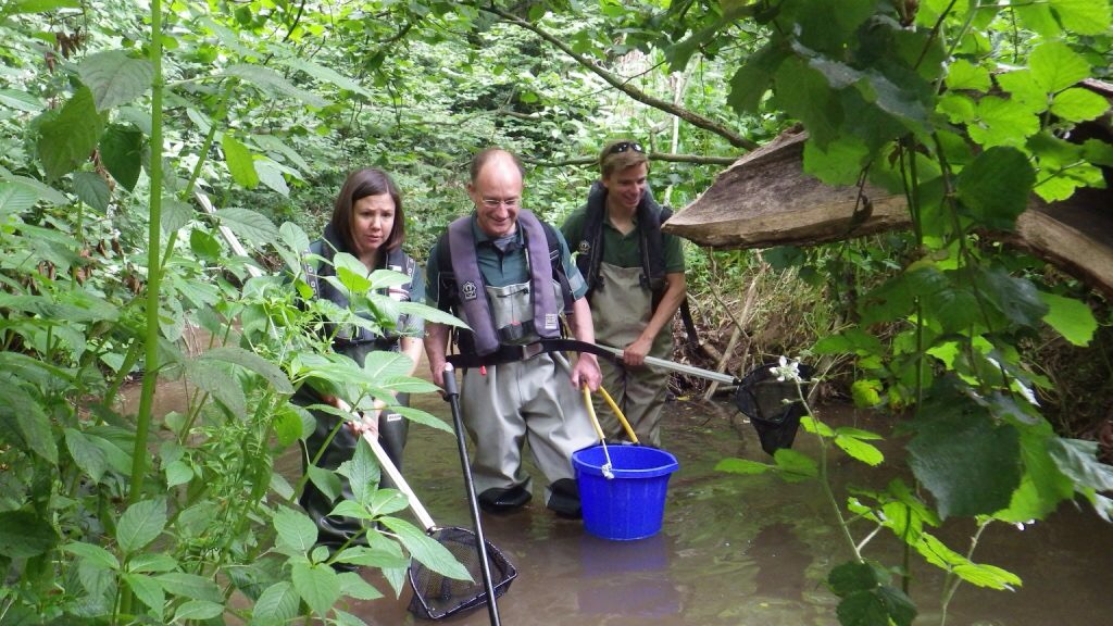
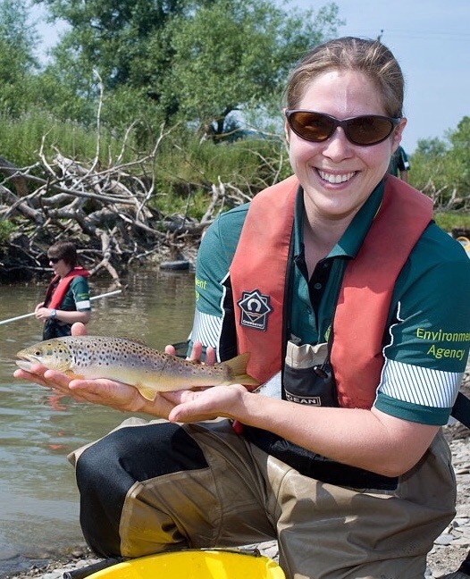
Our fish survey season got underway. One of the first tasks was the most challenging – catching fish in the mile wide Severn Estuary.
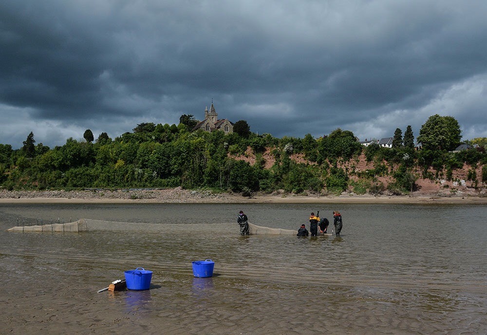
For fuller details see my earlier post, but we use a huge conical net called a fyke net which we leave staked in place and allow the tide to deliver fish to us!
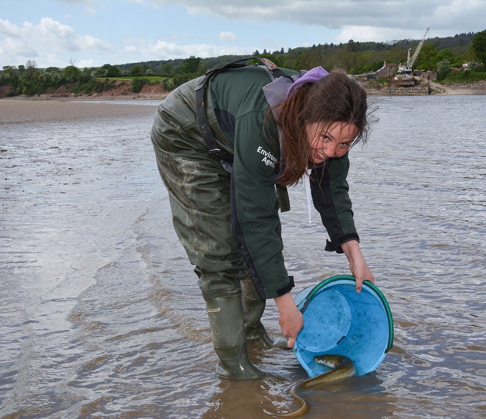
As you’d expect we catch a mix of sea and freshwater fish. This time mullet and sea bass were the main species with some fine large eels too.
June
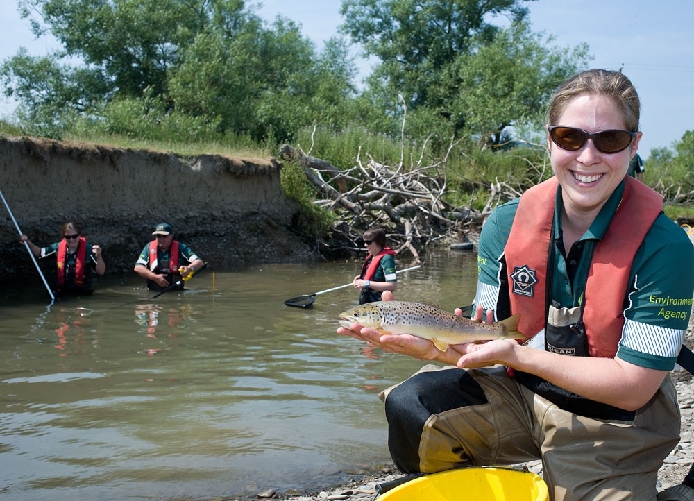
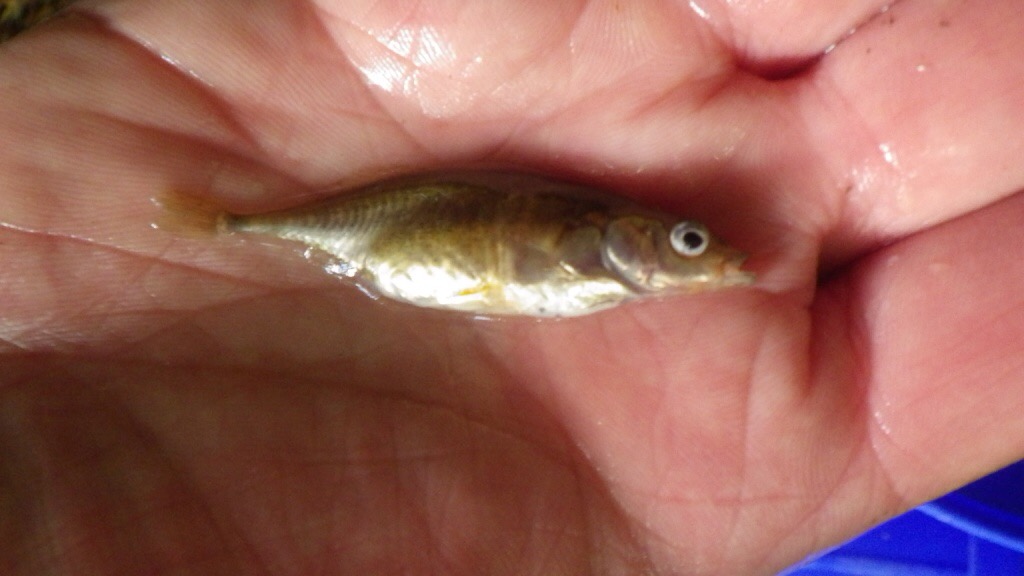
By June our fish survey programme is in full swing (providing there is no flooding!). Every year we survey dozens of sites on rivers and streams across the Severn and Wye catchments.
Most of our survey work is done by electrofishing (passing a small electric current through the water to stun fish). We sample all sorts of watercourses, from tiny streams to major rivers.
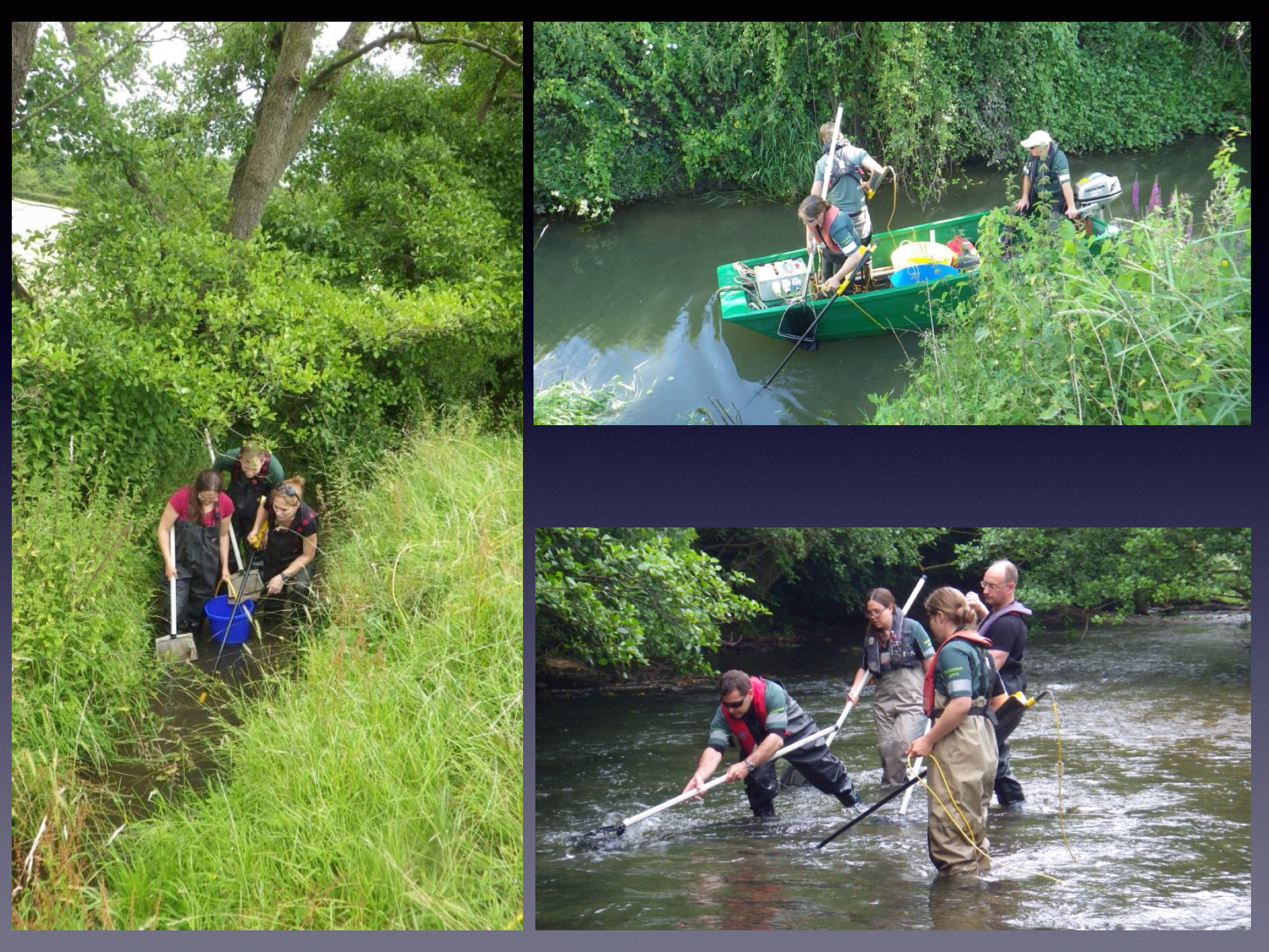
To make sure we can compare the information we gather we survey the same lengths and locations of river.
Overall, results during 2014 were very promising with good numbers of fish and a nice variety of species. We use the information to assess the overall health of the river and to plan and prioritise future action.
A few highlights included:
A nice flounder on the Longdon Brook in deepest Worcestershire

Native crayfish on the Rivers Onny and Lugg

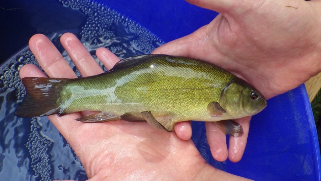
Huge hauls of coarse fish (including this tench) on the River Swilgate in Tewkesbury
Net fulls of lovely trout outside Waitrose in Cheltenham town centre

July
We were back in incident mode in July. Not because of floods this time, rather a major fire at a factory in Stroud.

The huge blaze was swiftly extinguished by our friends at Gloucestershire Fire and Rescue but we were very concerned about the possible impacts of contaminated water (used to put the fire out) escaping from the site. Fire-fighting water is always nasty stuff as it picks up chemicals from whatever is burning, but in this case we had two further reasons to be concerned. Firstly, there were a lot of chemicals stored on the site and we were unsure whether they had been burned and got into the fire water. Secondly, the factory backed directly onto the River Frome meaning the water wouldn’t have to travel far to get in.
For several days we worked with the Fire Brigade and the factory owners to prevent water escaping from the site as best we could and monitoring the river and surrounding environment for traces of chemicals or damage to wildlife.

Some contaminated water did get into the Frome but nowhere near as much as would have without our quick intervention and that of Gloucestershire Fire and Rescue.

We continued to monitor for several weeks but fortunately no significant problems were found.
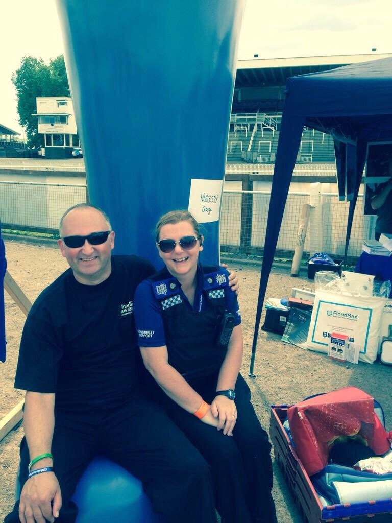
In July we also took part in the excellent SOS Fest at Worcester Racecourse. This is an event attended by all the emergency services and is an opportunity for the good folk of Worcester to see some impressive hardware and chat with front line officers.

Attendance was superb on a very hot Saturday, with numbers measured in the thousands.
We were able to provide lots of advice on flooding and how to avoid it and also to show off our practical skills with the flood barrier challenge.
A team of our finest chaps put up a length of flood barrier against the clock. Prizes were on offer for people guessing the time taken. Needless to say it got quite competitive!
For me it was a nice opportunity to do some more relaxed media interviews and spend some time with our fellow emergency responders.
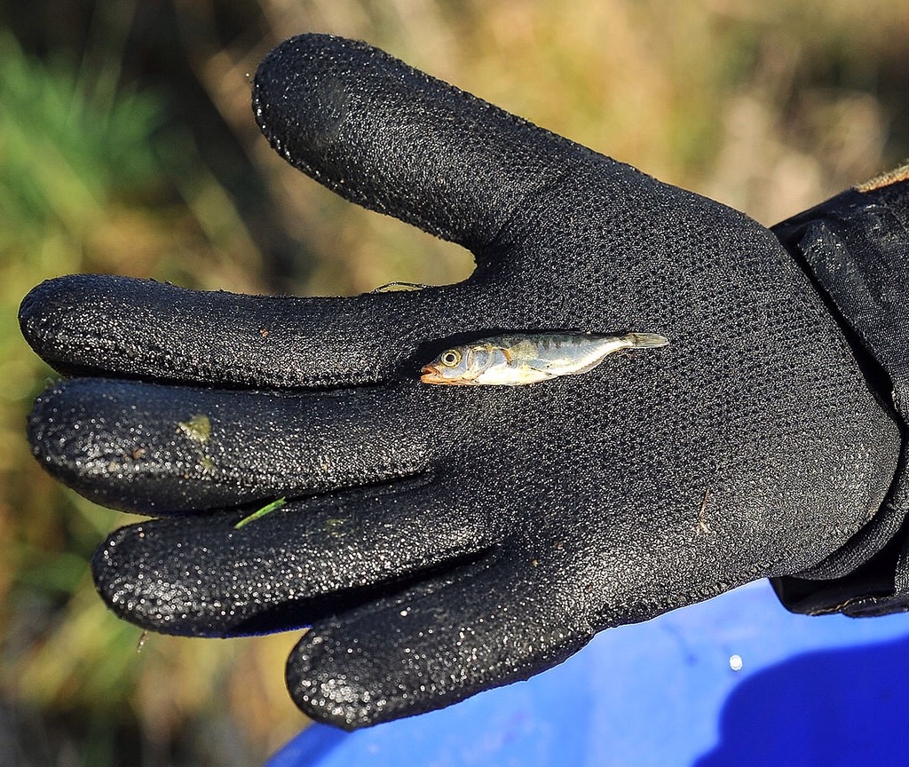
Ironically in what was a very wet year, by the end of July the top of the River Teme had been reduced to a trickle by a few weeks of dry weather. This is a fairly regular occurrence but causes the problem of large numbers of fish getting stranded in small pools of water that are rapidly drying out.

So we had to deploy the rescue team again to catch good numbers of salmon and trout and return them to safer locations downstream. By August the rains had return and the previously dry sections of the river became torrents!

August and September
Sadly it won’t be floods, fires or fish that I remember 2014 for. It will always be the year I lost my mum.

She died on August 4th after a long battle with cancer. Inevitably most of the rest of the month and much of September for me was about making funeral arrangements and sorting affairs.
October
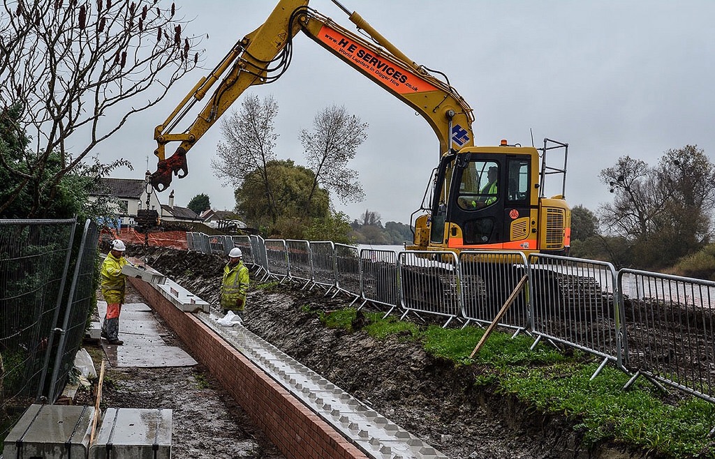
Immediately after last winter’s floods we carried out inspections of every inch of our flood defences (with help from the army). This was a massive task and took many months.

Overall they stood up very well to several months of pounding by record-breaking storms but, inevitably there was some damage, especially in the Severn Estuary. Fortunately the Government gave us some extra money to carry out repairs.
By the end of October all of our defences had been restored to full working order, ready for whatever winter 2014/15 throws at us!

It was good to visit Minsterworth again (see January/February) and see the repairs nearing completion.
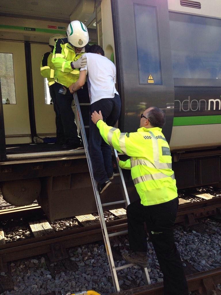
October also saw the biggest emergency exercise on our patch for quite a while. It took place at Shrub Hill station in Worcester and re-created a major train crash.

Hundreds of emergency responders took part with loads of volunteers playing the part of trapped and injured passengers. It was certainly realistic with plenty of blood and severed limbs scattered around!
It’s very reassuring to see the skills and levels of resources that can be mustered in the event of major incidents. Although only there as an observer I did manage to help quite a few “injured” passengers off the trains! Well, you’ve got to get stuck in, haven’t you!
November
We responded to hundreds of environmental incidents across our patch during 2014. An unusual one happened in November when a large lorry crashed on the main Hereford to Worcester road, blocking it completely and causing traffic chaos. Nowt to do with us you might say, but in this case as the lorry crashed it went through a hedge and demolished a 5000 litre oil tank on the other side.

What was left of the tank was buried under a huge pile of debris, making assessment of the impacts somewhat tricky.

Fortunately there was no watercourse nearby and the spilt oil could be contained and cleaned up without any significant damage to the environment. More importantly there were no serious injuries despite the carnage.
Once again, the incident highlights our close working relationship with other emergency services and the fact you never know what you’re going to get when you’re on duty!
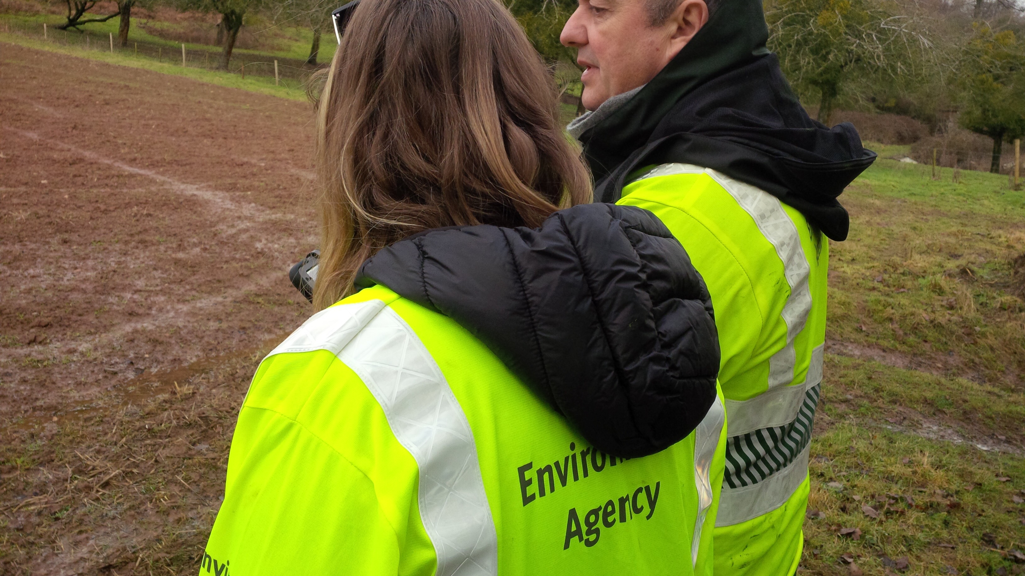
In November, we also welcomed Liz Truss, Secretary of State for Environment, Food and Rural Affairs, to Worcester.
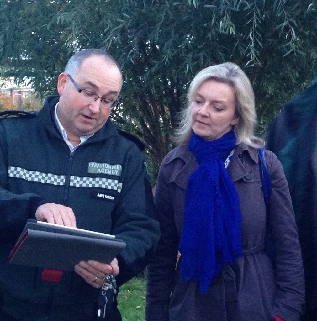
Along with other partners we were able to tell her about the response to flooding earlier in the year, the new flood defences created across Worcestershire and the challenges we all face in the future.
December
Just to show that things don’t always go to plan! In December we carried out a major fish netting operation at Upton Warren nature reserve near Droitwich. We were working with our friends at the Worcestershire Nature Conservation Trust who manage the site and want to know more about the type and numbers of fish in the pool so they can better plan future management.

Word was that the large pool (covering a couple of acres) was stuffed full of fish of all kinds. We were looking forward to a bumper haul.
Many hours later, having deployed our full range of nets and netting techniques we had caught a grand total of two fish, and one of those was a stickleback!
Our excuses were an unbelievable amount of silt and stinky mud, making access to the water tricky and unpleasant and loads of submerged rubbish, meaning large sweeps of the big nets were impossible. We’re still confident there’s a pile of fish in there – just that we didn’t catch them!
By year end we were starting to see the rivers beginning to rise again as soils became saturated and rainfall began to build up.

By the middle of the month we had to put up our barriers again at Shrewsbury, being careful to work around the panto timings at the theatre!

To our huge relief, Christmas flooding didn’t happen, allowing many of us the first Christmas off in three years. Which was nice!
So another eventful year came to an end. What 2015 will bring, I have no idea, but I suspect it won’t be boring!


 In
In 


 The impact of the tide is felt much higher up the river than Gloucester. Amazingly, during the February high tides the river at Upton in Worcestershire (about 60 miles from the estuary) was pushed into reverse twice a day. The graph below shows how normal flows of about 100 tonnes of water per second travelling downstream changed to an upstream flow of up to 40 tonnes per second in a matter of minutes. There was also an accompanying rapid rise in water levels of over half a metre. Incredible!
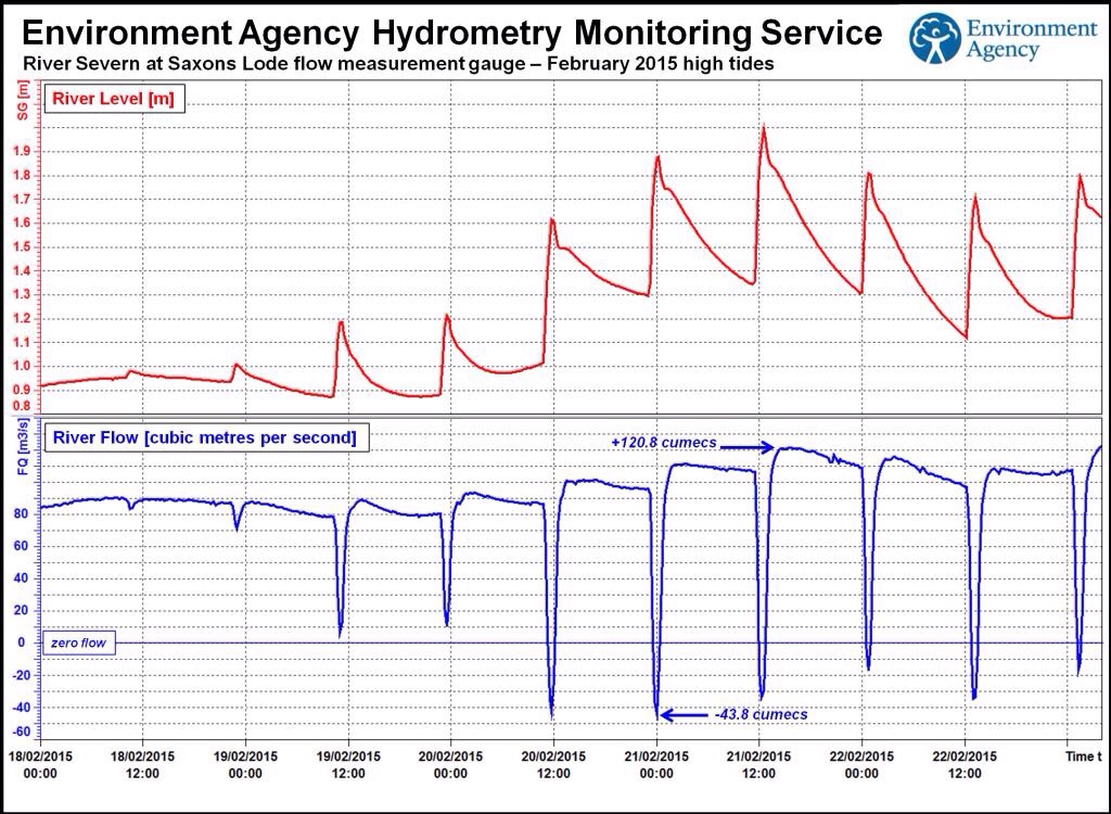
 When high tides are imminent we check all our defences to ensure they are in good working order. This is no small task given the extent of the defences and the remote nature of parts of the estuary.

